Tollesbury General Information
Tollesbury is a village in England, located on the Essex coast at the mouth of the River Blackwater. It is situated nine miles east of the historic port of Maldon and 12 miles south of Colchester (Britain's oldest recorded town).
For centuries Tollesbury, the village of the plough and sail, relied on the harvests of the land and the sea.
The village sign:
On the 'Plough' side of the carved village sign the ploughman and his team of horses are depicted working the land, agriculture goes on down to the waters edge. Pictured on the right of the sign are fishing smacks on the River Blackwater. The village church can be seen on the top left side of the sign. A mallard and a hare are pictured on the supports.
The 'Sail' side of the sign shows the weather boarded Sail lofts. The centre of the sign shows the yacht 'Endeavour II' which was the 1937 British challenger for the America's Cup, on the left is depicted the fishing smack 'Sallie'. Oysters and fish, harvests from the Blackwater, are shown on the supports.
Features of the village
At one time Tollesbury was served by six public houses, the village now has only one: The Kings Head. The other, recently remaining, Hope Inn, built in 1923 stood in the High Street on the site of the previous Hope Inn and is now being sold for housing development (2011).
At the centre of the village is 'The Square', which was also known as 'The Green' but correctly called Church Street. On the west side of the Square is the Kings Head Public House, which was traditionally the seafarers public house. It was here that the Tollesbury Yacht Skippers Club was formed when the village was gaining a reputation as a yachting centre during the early part of the 20th century. Alterations were made to the pub in 1902 during which parts of a copy of the Great Bible of 1540 were found in the attic.
Cottages line either side of the Square, some of which have been built using bricks which were manufactured locally. On the east side of the Square is the Village Lock-up and Saint Mary's church. Tucked away in the south east corner of The Square, by the church wall stands the village Lock-up or Cage. This wooden building would have been where drunks were held until they sobered up. With the village having six public houses at one stage, the Lock-up probably saw quite a bit of business itself!
Church
The parish church of Tollesbury, dedicated to Saint Mary the Virgin, stands at the highest point in the village. It is generally assumed that the church was built just after the Norman Conquest, around 1090, rather than in Saxon times. It is possible that the materials used in the present building are taken from an earlier Saxon church.
In Mediaeval times the parish church was the property of Saint Mary's nunnery at Barking, the nunnery was responsible for the appointment of the clergyman to the parish. When the nunnery was dissolved by Henry VIII in 1539, the manor was given to Thomas, Lord Cromwell a few days before he was made Earl of Essex. The gift of the living has passed through many hands, and now rests with Exeter College, Oxford and the Bishop of Chelmsford. The tower of the church is a most imposing structure and it may well be that here was a place of refuge for parishioners in time of attack from marauders across the North Sea.
The lowest stage of the tower dates from the 11th Century and consists of rubble, flint and conglomerite walling with freestone quoins. The doorway is typical of the Tudor period. Above this stage are two more windows with 15th Century brickwork. The largest window in the tower is in the perpendicular style and the highest windows of brick were shaped in Tudor times. The tower is capped by parapet walls and pinnacles dating from the 17th Century. Buttresses are made from flint and brick.
Transport
The village was once served by a light railway, the Kelvedon and Tollesbury Light Railway.
The Kelvedon and Tollesbury Light Railway operated in Essex between 1904 and 1951. It was authorised under the Light Railways Act 1896. It connected Kelvedon and Tollesbury. There were intermediate stations at Feering, Inworth, Tiptree, Tolleshunt Knights and Tolleshunt D’Arcy, with an extension to Tollesbury Pier.
The Crab and Winkle Line was a light railway line. This meant essentially that the carriages were small in number. It also meant that there could be passenger and goods carriages at the same time. The trains were slow. The maximum speed allowed was 25 miles per hour in the countryside and only 10 miles per hour through
villages. Villages served were Tollesbury, Tolleshunt D'Arcy, Tolleshunt Knights, Tiptree, Inworth, Feering and Kelvedon.
The line opened in 1904. It was soon extended as far as Tollesbury Pier. It closed on May 5th 1951.
It served as a passenger train. For example it opened up the prospect of secretaries and office staff travelling to London (Liverpoool Street) easily.
It served to carry fresh sea produce quickly to the metropolis. It also served to distribute more efficiently the world famous Wilkins Jams from Tiptree. John Wilkin, grandson of the founder Arthur Wilkin was a main instigator behind the development of the line.
Adapted from Free Wikipedia September 2011
Links
Google Street View
The Church
The Crab and Winkle Line
You Tube Kelvedon and Tollesbury Branch Line
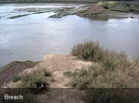
Tollesbury managed realignment
| coastalsetback.pdf |
Select the image or pdf icon above for a report that describes research completed at the Tollesbury managed re-alignment site between 2003 and 2008. It will be of use to any organisation intending to create managed re-alignment sites in the future.
Joint Defra/EA Flood and Coastal Erosion Risk Management R&D Programme
Managed realignment at Tollesbury © Crown copyright (Defra);(2008)
Copyright in the typographical arrangement and design rests with the Crown. This publication (excluding the logo) may be reproduced free of charge in any format or medium provided that it is reproduced accurately and not used in a misleading context. The material must be acknowledged as Crown copyright with the title and source of the publication specified.
